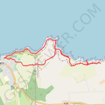
Walk along the coast near Cullen
Interactive trail map
Trail profile
- Distance: 6.4 mi
- Elevation gain: 902 ft
- Maximum elevation: 246 ft
- Elevation loss: 906 ft
- Minimum elevation: 0 ft
- Moving time: 3 h 21 m
- Moving speed: 1.9 mph
- Maximum speed: 4.9 mph
- Total time: 4 h 27 m
- Global speed: 1.4 mph
About this trail
Name: Walk along the coast near Cullen trail, distance, elevation, map, profile, GPS track
Start: Port Long Road, Cullen, Moray, Scotland, AB56 4AG, United Kingdom (57.69416 -2.81941)
End: Port Long Road, Cullen, Moray, Scotland, AB56 4AG, United Kingdom (57.69417 -2.81947)
Coordinates: 57.69086 -2.82110 57.69982 -2.76164