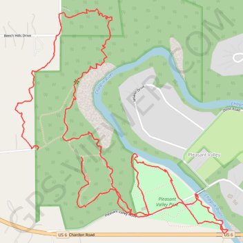
Hach-Otis hike
- Distance: 3.4 mi
- Elevation gain: 433 ft
- Maximum elevation: 853 ft
- Elevation loss: 446 ft
- Minimum elevation: 659 ft
Interactive trail map
Trail profile
- Distance: 3.4 mi
- Elevation gain: 433 ft
- Maximum elevation: 853 ft
- Elevation loss: 446 ft
- Minimum elevation: 659 ft
About this trail
Name: Hach-Otis hike trail, distance, elevation, map, profile, GPS track
Start: Skyline Drive, Willoughby Hills, Lake County, Ohio, 44094, United States (41.59104 -81.40923)
End: Skyline Drive, Willoughby Hills, Lake County, Ohio, 44094, United States (41.59139 -81.41165)
Coordinates: 41.58781 -81.41293 41.59726 -81.40098
Topography: Lake County topographic map, elevation, terrain