Exploring Farnhill
Run
- Distance: 3.1 mi
- Elevation gain: 423 ft
- Maximum elevation: 673 ft
- Elevation loss: 430 ft
- Minimum elevation: 299 ft
- Moving time: 1 h 1 m
- Moving speed: 3.0 mph
- Maximum speed: 6.0 mph
- Total time: 1 h 5 m
- Global speed: 2.9 mph
Interactive trail map
Trail profile
- Distance: 3.1 mi
- Elevation gain: 423 ft
- Maximum elevation: 673 ft
- Elevation loss: 430 ft
- Minimum elevation: 299 ft
- Moving time: 1 h 1 m
- Moving speed: 3.0 mph
- Maximum speed: 6.0 mph
- Total time: 1 h 5 m
- Global speed: 2.9 mph
About this trail
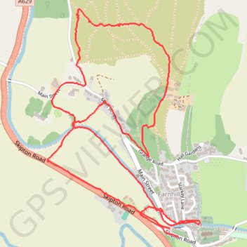
Name: Exploring Farnhill trail, distance, elevation, map, profile, GPS track
Coordinates: 53.90900 -1.99574 53.91896 -1.98446