Make a donation
Gear up for your next adventure:
As an Amazon Associate, this site earns from qualifying purchases at no extra cost to you.
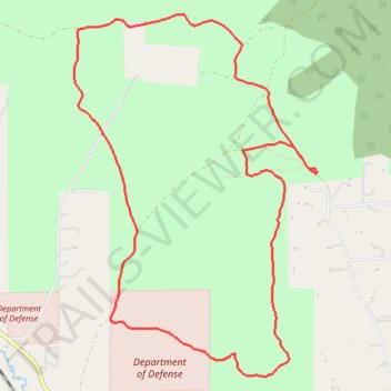
Scratchgravel Loop MTB
- Distance: 6.1 mi
- Elevation gain: 748 ft
- Maximum elevation: 4,557 ft
- Elevation loss: 748 ft
- Minimum elevation: 4,239 ft
- Moving time: 52 m 50 s
- Moving speed: 7.0 mph
- Maximum speed: 25.9 mph
- Total time: 1 h 23 m
- Global speed: 4.4 mph
Interactive trail map
Make a donation
Gear up for your next adventure:
As an Amazon Associate, this site earns from qualifying purchases at no extra cost to you.
Trail profile
- Distance: 6.1 mi
- Elevation gain: 748 ft
- Maximum elevation: 4,557 ft
- Elevation loss: 748 ft
- Minimum elevation: 4,239 ft
- Moving time: 52 m 50 s
- Moving speed: 7.0 mph
- Maximum speed: 25.9 mph
- Total time: 1 h 23 m
- Global speed: 4.4 mph
Make a donation
Gear up for your next adventure:
As an Amazon Associate, this site earns from qualifying purchases at no extra cost to you.
About this trail
Name: Scratchgravel Loop MTB trail, distance, elevation, map, profile, GPS track
Start: Scratch Gravels Doubletrack, Lewis and Clark County, Montana, United States (46.66791 -112.09503)
End: Scratch Gravels Doubletrack, Lewis and Clark County, Montana, United States (46.66786 -112.09498)
Coordinates: 46.65347 -112.11997 46.67921 -112.09483
Topography: Lewis and Clark County topographic map, elevation, terrain
Make a donation
Gear up for your next adventure:
As an Amazon Associate, this site earns from qualifying purchases at no extra cost to you.
Other hiking, mountain biking, running and outdoor activity trails
Click on a trail to view its statistics, map and profile.
Scratchgravel Hills Mountain Biking
United States > Montana > Lewis and Clark County
Distance: 8.7 mi • Elevation gain: 1,257 ft • Maximum elevation: 4,701 ft