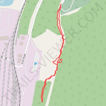
King Tree, Secret Fort
- Distance: 0.9 mi
- Elevation gain: 115 ft
- Maximum elevation: 213 ft
- Elevation loss: 115 ft
- Minimum elevation: 121 ft
- Moving time: 47 m 44 s
- Moving speed: 1.1 mph
- Maximum speed: 5.1 mph
- Total time: 1 h 26 m
- Global speed: 0.6 mph
Interactive trail map
Trail profile
- Distance: 0.9 mi
- Elevation gain: 115 ft
- Maximum elevation: 213 ft
- Elevation loss: 115 ft
- Minimum elevation: 121 ft
- Moving time: 47 m 44 s
- Moving speed: 1.1 mph
- Maximum speed: 5.1 mph
- Total time: 1 h 26 m
- Global speed: 0.6 mph
About this trail
Name: King Tree, Secret Fort trail, distance, elevation, map, profile, GPS track
Coordinates: 54.28508 -130.35368 54.29016 -130.35163
Other hiking, mountain biking, running and outdoor activity trails
Click on a trail to view its statistics, map and profile.
First Fort Trail
Canada > British Columbia > North Coast Regional District > Prince Rupert
Distance: 3.0 mi • Elevation gain: 564 ft • Maximum elevation: 305 ft
Fairview Cemetery and King Loop
Canada > British Columbia > North Coast Regional District > Prince Rupert
Distance: 2.3 mi • Elevation gain: 456 ft • Maximum elevation: 358 ft