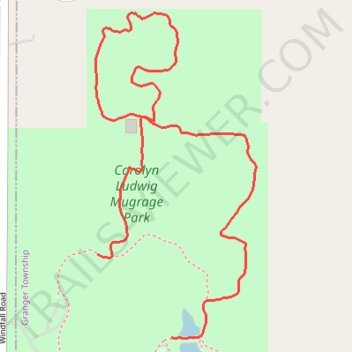
Carolyn Ludwig Mugrage Park
- Distance: 1.3 mi
- Elevation gain: 26 ft
- Maximum elevation: 1,194 ft
- Elevation loss: 23 ft
- Minimum elevation: 1,175 ft
- Moving time: 31 m 10 s
- Moving speed: 2.4 mph
- Maximum speed: 3.7 mph
- Total time: 31 m 10 s
- Global speed: 2.4 mph
Interactive trail map
Trail profile
- Distance: 1.3 mi
- Elevation gain: 26 ft
- Maximum elevation: 1,194 ft
- Elevation loss: 23 ft
- Minimum elevation: 1,175 ft
- Moving time: 31 m 10 s
- Moving speed: 2.4 mph
- Maximum speed: 3.7 mph
- Total time: 31 m 10 s
- Global speed: 2.4 mph
About this trail
Name: Carolyn Ludwig Mugrage Park trail, distance, elevation, map, profile, GPS track
Start: Medina Road, Granger Township, Medina County, Ohio, United States (41.13914 -81.78105)
End: Medina Road, Granger Township, Medina County, Ohio, United States (41.14066 -81.78285)
Coordinates: 41.13912 -81.78290 41.14508 -81.77900
Topography: Medina County topographic map, elevation, terrain