Route
- Distance: 1.9 mi
- Elevation gain: 522 ft
- Maximum elevation: 1,913 ft
- Elevation loss: 522 ft
- Minimum elevation: 1,470 ft
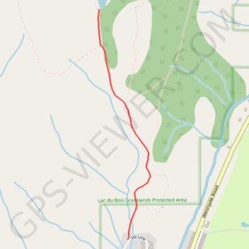
Interactive trail map
Trail profile
- Distance: 1.9 mi
- Elevation gain: 522 ft
- Maximum elevation: 1,913 ft
- Elevation loss: 522 ft
- Minimum elevation: 1,470 ft
About this trail
Name: Route trail, distance, elevation, map, profile, GPS track
Coordinates: 50.78088 -120.34650 50.79352 -120.34194
Other hiking, mountain biking, running and outdoor activity trails
Click on a trail to view its statistics, map and profile.
Cache Creek - Kamloops
Canada > British Columbia > Thompson-Nicola Regional District > Cache Creek
Distance: 54.0 mi • Elevation gain: 3,655 ft • Maximum elevation: 2,415 ft
Lac du Bois - Grasslands Community Trail
Canada > British Columbia > Thompson-Nicola Regional District > Kamloops
Distance: 8.1 mi • Elevation gain: 2,503 ft • Maximum elevation: 3,323 ft
Lac du Bois - Deep Lake Loop Trail
Canada > British Columbia > Thompson-Nicola Regional District > Kamloops
Distance: 3.6 mi • Elevation gain: 823 ft • Maximum elevation: 1,916 ft
Route
Canada > British Columbia > Thompson-Nicola Regional District > Area J (Copper Desert Country)
Distance: 7.0 mi • Elevation gain: 469 ft • Maximum elevation: 3,307 ft