Import a GPX file

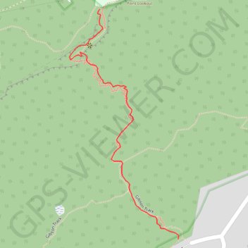
Sublime Point Lookout

Illawarra Escarpment State Conservation Area. #Hiking #Illawarra

  • Distance: 0.6 mi
  • Elevation gain: 889 ft
  • Maximum elevation: 1,266 ft
  • Elevation loss: 0 ft
  • Minimum elevation: 377 ft
  • Moving time: 19 m 11 s
  • Moving speed: 1.9 mph
  • Maximum speed: 4.1 mph
  • Total time: 21 m 30 s
  • Global speed: 1.7 mph

Interactive trail map

Trail profile

  • Distance: 0.6 mi
  • Elevation gain: 889 ft
  • Maximum elevation: 1,266 ft
  • Elevation loss: 0 ft
  • Minimum elevation: 377 ft
  • Moving time: 19 m 11 s
  • Moving speed: 1.9 mph
  • Maximum speed: 4.1 mph
  • Total time: 21 m 30 s
  • Global speed: 1.7 mph

About this trail

Other hiking, mountain biking, running and outdoor activity trails

Click on a trail to view its statistics, map and profile.

Minnamurra - Royal National Park - Sydney

Australia > New South Wales > Minnamurra

#Bike #Royal #Sydney

Distance: 78.3 mi • Elevation gain: 4,537 ft • Maximum elevation: 738 ft

Sydney - Wollongong

Australia > New South Wales > Sydney

Royal National Park. #Bike #Royal #Sydney

Distance: 55.3 mi • Elevation gain: 3,825 ft • Maximum elevation: 794 ft

Gear up for your next adventure:

📖Nature Tracking Books - Learn to track wildlife and terrain
⛑️Personal Locator Beacon - Safety beacon for emergencies
🖼️Topo Map Wall Art - Decorative topographic prints of famous peaks and regions
🧭Orienteering Set - Complete compass and map reading kit
📌Outdoor GPS Map App - Apps and devices for digital topographic navigation

As an Amazon Associate, this site earns from qualifying purchases at no extra cost to you.