Single Nahal Bustan
נחל בוסטן - רון
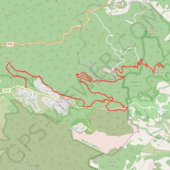
- Distance: 18.1 mi
- Elevation gain: 2,051 ft
- Maximum elevation: 1,601 ft
- Elevation loss: 2,051 ft
- Minimum elevation: 404 ft
- Moving time: 2 h 8 m
- Moving speed: 8.5 mph
- Maximum speed: 20.2 mph
- Total time: 2 h 41 m
- Global speed: 6.7 mph
Interactive trail map
Trail profile
- Distance: 18.1 mi
- Elevation gain: 2,051 ft
- Maximum elevation: 1,601 ft
- Elevation loss: 2,051 ft
- Minimum elevation: 404 ft
- Moving time: 2 h 8 m
- Moving speed: 8.5 mph
- Maximum speed: 20.2 mph
- Total time: 2 h 41 m
- Global speed: 6.7 mph
About this trail
Name: Single Nahal Bustan trail, distance, elevation, map, profile, GPS track
Coordinates: 32.69595 34.97586 32.71033 35.02760
Other hiking, mountain biking, running and outdoor activity trails
Click on a trail to view its statistics, map and profile.
עין הוד
Israel > Haifa District > Hof HaCarmel Regional Council
Morning Ride
Distance: 17.8 mi • Elevation gain: 2,592 ft • Maximum elevation: 1,598 ft
Home78Rec
Israel > Haifa District > Nesher
Distance: 48.7 mi • Elevation gain: 4,852 ft • Maximum elevation: 1,512 ft