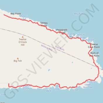
Mickeleen's Path, East Cost Trail (ECT)
Mickeleen's Path
- Distance: 4.5 mi
- Elevation gain: 938 ft
- Maximum elevation: 217 ft
- Elevation loss: 932 ft
- Minimum elevation: 3 ft
- Moving time: 2 h 8 m
- Moving speed: 2.1 mph
- Maximum speed: 3.2 mph
- Total time: 2 h 14 m
- Global speed: 2.0 mph
Interactive trail map
Trail profile
- Distance: 4.5 mi
- Elevation gain: 938 ft
- Maximum elevation: 217 ft
- Elevation loss: 932 ft
- Minimum elevation: 3 ft
- Moving time: 2 h 8 m
- Moving speed: 2.1 mph
- Maximum speed: 3.2 mph
- Total time: 2 h 14 m
- Global speed: 2.0 mph
About this trail
Name: Mickeleen's Path, East Cost Trail (ECT) trail, distance, elevation, map, profile, GPS track
Coordinates: 47.28380 -52.80312 47.30213 -52.76815