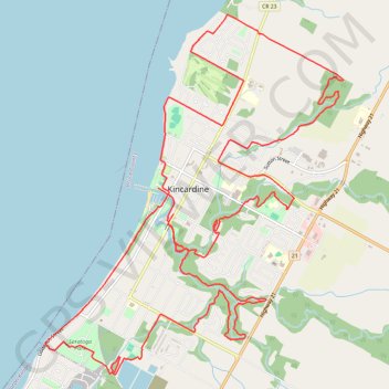
Tour of Kincardine
Lake Huron. #Bike #Loop #Kincardine #Huron
- Distance: 15.4 mi
- Elevation gain: 656 ft
- Maximum elevation: 748 ft
- Elevation loss: 627 ft
- Minimum elevation: 577 ft
Interactive trail map
Trail profile
- Distance: 15.4 mi
- Elevation gain: 656 ft
- Maximum elevation: 748 ft
- Elevation loss: 627 ft
- Minimum elevation: 577 ft
About this trail
Name: Tour of Kincardine trail, distance, elevation, map, profile, GPS track
Start: 180, Harbour Street, Kincardine, Bruce County, Ontario, N2Z 2X9, Canada (44.17767 -81.63950)
End: 697, Queen Street, Kincardine, Bruce County, Ontario, N2Z 2A3, Canada (44.17480 -81.63707)
Coordinates: 44.15707 -81.65682 44.19688 -81.61091