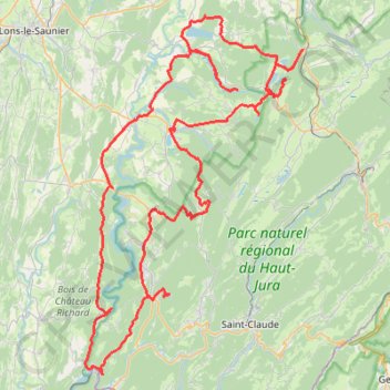
Route des lacs du Jura
- Distance: 108.8 mi
- Elevation gain: 10,069 ft
- Maximum elevation: 3,110 ft
- Elevation loss: 10,069 ft
- Minimum elevation: 1,010 ft
- Moving time: 1 d 10 h
- Moving speed: 3.1 mph
- Maximum speed: 4.0 mph
- Total time: 1 d 10 h
- Global speed: 3.1 mph
Interactive trail map
Trail profile
- Distance: 108.8 mi
- Elevation gain: 10,069 ft
- Maximum elevation: 3,110 ft
- Elevation loss: 10,069 ft
- Minimum elevation: 1,010 ft
- Moving time: 1 d 10 h
- Moving speed: 3.1 mph
- Maximum speed: 4.0 mph
- Total time: 1 d 10 h
- Global speed: 3.1 mph
About this trail
Name: Route des lacs du Jura trail, distance, elevation, map, profile, GPS track
Coordinates: 46.33771 5.63152 46.68810 5.94062
Other hiking, mountain biking, running and outdoor activity trails
Click on a trail to view its statistics, map and profile.
PT23DS2 Lörrach → Cadaqués
Germany > Baden-Württemberg > Landkreis Lörrach > Lörrach (Kernstadt)
Distance: 652.9 mi • Elevation gain: 43,077 ft • Maximum elevation: 4,938 ft