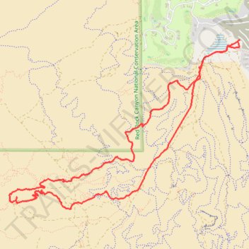
Mesa Brown Canyon Loop
- Distance: 6.7 mi
- Elevation gain: 741 ft
- Maximum elevation: 3,573 ft
- Elevation loss: 745 ft
- Minimum elevation: 2,900 ft
- Moving time: 2 h 15 m
- Moving speed: 2.9 mph
- Maximum speed: 3.7 mph
- Total time: 2 h 24 m
- Global speed: 2.8 mph
Interactive trail map
Trail profile
- Distance: 6.7 mi
- Elevation gain: 741 ft
- Maximum elevation: 3,573 ft
- Elevation loss: 745 ft
- Minimum elevation: 2,900 ft
- Moving time: 2 h 15 m
- Moving speed: 2.9 mph
- Maximum speed: 3.7 mph
- Total time: 2 h 24 m
- Global speed: 2.8 mph
About this trail
Name: Mesa Brown Canyon Loop trail, distance, elevation, map, profile, GPS track
Coordinates: 36.07761 -115.37213 36.09857 -115.33678
Topography: Clark County topographic map, elevation, terrain
Other hiking, mountain biking, running and outdoor activity trails
Click on a trail to view its statistics, map and profile.
Summerin south mesa ridge explore
United States > Nevada > Clark County > Summerlin South
Distance: 7.5 mi • Elevation gain: 1,096 ft • Maximum elevation: 3,412 ft