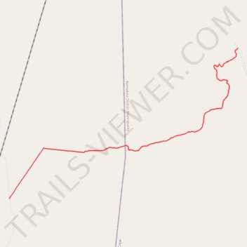
Thank you for supporting this site ❤️
Make a donation
Make a donation
Gear up for your next adventure:
As an Amazon Associate, this site earns from qualifying purchases at no extra cost to you.
Hel se Pad Pass
- Distance: 10.3 mi
- Elevation gain: 1,903 ft
- Maximum elevation: 2,638 ft
- Elevation loss: 36 ft
- Minimum elevation: 768 ft
- Moving time: 41 m 59 s
- Moving speed: 14.8 mph
- Maximum speed: 26.9 mph
- Total time: 43 m 42 s
- Global speed: 14.2 mph
Interactive trail map
Thank you for supporting this site ❤️
Make a donation
Make a donation
Gear up for your next adventure:
As an Amazon Associate, this site earns from qualifying purchases at no extra cost to you.
Trail profile
- Distance: 10.3 mi
- Elevation gain: 1,903 ft
- Maximum elevation: 2,638 ft
- Elevation loss: 36 ft
- Minimum elevation: 768 ft
- Moving time: 41 m 59 s
- Moving speed: 14.8 mph
- Maximum speed: 26.9 mph
- Total time: 43 m 42 s
- Global speed: 14.2 mph
Thank you for supporting this site ❤️
Make a donation
Make a donation
Gear up for your next adventure:
As an Amazon Associate, this site earns from qualifying purchases at no extra cost to you.
About this trail
Name: Hel se Pad Pass trail, distance, elevation, map, profile, GPS track
Coordinates: -31.21338 18.89336 -31.15083 19.00458
Thank you for supporting this site ❤️
Make a donation
Make a donation
Gear up for your next adventure:
As an Amazon Associate, this site earns from qualifying purchases at no extra cost to you.