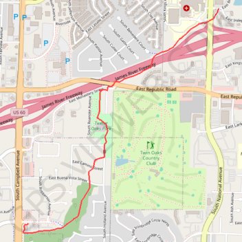
Ward Branch Greenway
- Distance: 2.0 mi
- Elevation gain: 43 ft
- Maximum elevation: 1,266 ft
- Elevation loss: 105 ft
- Minimum elevation: 1,191 ft
- Moving time: 13 m 59 s
- Moving speed: 8.4 mph
- Maximum speed: 17.1 mph
- Total time: 13 m 59 s
- Global speed: 8.4 mph
Interactive trail map
Trail profile
- Distance: 2.0 mi
- Elevation gain: 43 ft
- Maximum elevation: 1,266 ft
- Elevation loss: 105 ft
- Minimum elevation: 1,191 ft
- Moving time: 13 m 59 s
- Moving speed: 8.4 mph
- Maximum speed: 17.1 mph
- Total time: 13 m 59 s
- Global speed: 8.4 mph
About this trail
Name: Ward Branch Greenway trail, distance, elevation, map, profile, GPS track
Coordinates: 37.12727 -93.29598 37.14434 -93.27724
Topography: Springfield topographic map, elevation, terrain