Devil's Den Loop Trail in Devil's Den State Park
The Devil's Den Loop Trail offers a dynamic hiking experience through the rugged terrain of the Ozark Mountains. This moderate trail features stunning rock formations, including Devil's Den Cave and crevices, and the chance to see seasonal waterfalls along with lush plant life. With its mix of natural beauty, geological interest, and occasional wildlife sightings, it’s an ideal hike for those looking to connect with Arkansas's outdoor splendor. #Hiking #Loop #Cave #Forest #Nature
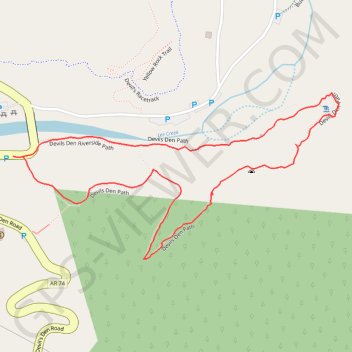
- Distance: 1.1 mi
- Elevation gain: 171 ft
- Maximum elevation: 1,178 ft
- Elevation loss: 171 ft
- Minimum elevation: 1,043 ft
- Moving time: 39 m 15 s
- Moving speed: 1.7 mph
- Maximum speed: 3.0 mph
- Total time: 40 m 59 s
- Global speed: 1.7 mph
Interactive trail map
Trail profile
- Distance: 1.1 mi
- Elevation gain: 171 ft
- Maximum elevation: 1,178 ft
- Elevation loss: 171 ft
- Minimum elevation: 1,043 ft
- Moving time: 39 m 15 s
- Moving speed: 1.7 mph
- Maximum speed: 3.0 mph
- Total time: 40 m 59 s
- Global speed: 1.7 mph
About this trail
Name: Devil's Den Loop Trail in Devil's Den State Park trail, distance, elevation, map, profile, GPS track
Start: AR 170, Washington County, Arkansas, 72774, United States (35.78135 -94.24953)
End: AR 170, Washington County, Arkansas, 72774, United States (35.78136 -94.24973)
Coordinates: 35.77957 -94.24973 35.78246 -94.24278
Topography: Washington County topographic map, elevation, terrain
Other hiking, mountain biking, running and outdoor activity trails
Click on a trail to view its statistics, map and profile.
Yellow Rock Loop Trail in Devil's Den State Park
United States > Arkansas > Washington County
The Yellow Rock Loop Trail offers a captivating hiking experience characterized by unique rock formations, scenic overlooks, and a blend of shaded woodland paths. As you ascend, you'll encounter a variety of natural features, including sandstone crevices and bluffs, leading to the impressive Yellow Rock…
Distance: 2.7 mi • Elevation gain: 541 ft • Maximum elevation: 1,437 ft