Veliki_krcimir-litica
- Distance: 3.8 mi
- Elevation gain: 3,684 ft
- Maximum elevation: 5,499 ft
- Elevation loss: 3 ft
- Minimum elevation: 1,814 ft
Interactive trail map
Trail profile
- Distance: 3.8 mi
- Elevation gain: 3,684 ft
- Maximum elevation: 5,499 ft
- Elevation loss: 3 ft
- Minimum elevation: 1,814 ft
About this trail
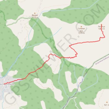
Name: Veliki_krcimir-litica trail, distance, elevation, map, profile, GPS track
Coordinates: 43.09865 22.20902 43.11828 22.25457