Make a donation
Gear up for your next adventure:
As an Amazon Associate, this site earns from qualifying purchases at no extra cost to you.
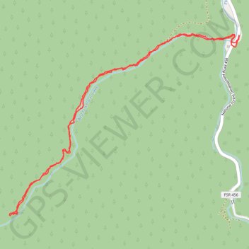
Hike of the Pulaski Tunnel Trail
Evening hike
- Distance: 4.1 mi
- Elevation gain: 974 ft
- Maximum elevation: 3,707 ft
- Elevation loss: 968 ft
- Minimum elevation: 2,907 ft
- Moving time: 1 h 27 m
- Moving speed: 2.8 mph
- Maximum speed: 10.6 mph
- Total time: 1 h 52 m
- Global speed: 2.2 mph
Interactive trail map
Make a donation
Gear up for your next adventure:
As an Amazon Associate, this site earns from qualifying purchases at no extra cost to you.
Trail profile
- Distance: 4.1 mi
- Elevation gain: 974 ft
- Maximum elevation: 3,707 ft
- Elevation loss: 968 ft
- Minimum elevation: 2,907 ft
- Moving time: 1 h 27 m
- Moving speed: 2.8 mph
- Maximum speed: 10.6 mph
- Total time: 1 h 52 m
- Global speed: 2.2 mph
Make a donation
Gear up for your next adventure:
As an Amazon Associate, this site earns from qualifying purchases at no extra cost to you.
About this trail
Name: Hike of the Pulaski Tunnel Trail trail, distance, elevation, map, profile, GPS track
Start: Pulaski Tunnel Trail, Shoshone County, Idaho, 83873, United States (47.45929 -115.93509)
End: Moon Pass Road, Shoshone County, Idaho, 83873, United States (47.45931 -115.93502)
Coordinates: 47.44589 -115.96048 47.45949 -115.93502
Topography: Shoshone County topographic map, elevation, terrain
Make a donation
Gear up for your next adventure:
As an Amazon Associate, this site earns from qualifying purchases at no extra cost to you.