Reptar Loop Trail
Lunch Run
- Distance: 3.6 mi
- Elevation gain: 551 ft
- Maximum elevation: 2,657 ft
- Elevation loss: 551 ft
- Minimum elevation: 2,484 ft
- Moving time: 35 m 4 s
- Moving speed: 6.2 mph
- Maximum speed: 11.0 mph
- Total time: 35 m 4 s
- Global speed: 6.2 mph
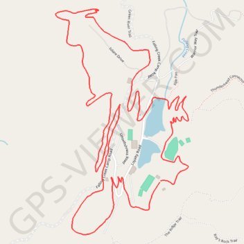
Interactive trail map
Trail profile
- Distance: 3.6 mi
- Elevation gain: 551 ft
- Maximum elevation: 2,657 ft
- Elevation loss: 551 ft
- Minimum elevation: 2,484 ft
- Moving time: 35 m 4 s
- Moving speed: 6.2 mph
- Maximum speed: 11.0 mph
- Total time: 35 m 4 s
- Global speed: 6.2 mph
About this trail
Name: Reptar Loop Trail trail, distance, elevation, map, profile, GPS track
Start: The Ridge Trail, Henderson County, North Carolina, 28790, United States (35.18866 -82.47519)
End: Green River Trail, Henderson County, North Carolina, 28790, United States (35.18873 -82.47514)
Coordinates: 35.18638 -82.48073 35.19621 -82.47366
Topography: Henderson County topographic map, elevation, terrain
Other hiking, mountain biking, running and outdoor activity trails
Click on a trail to view its statistics, map and profile.
Green River Loop Trail
United States > North Carolina > Henderson County
Morning Hike
Distance: 6.0 mi • Elevation gain: 1,047 ft • Maximum elevation: 2,671 ft