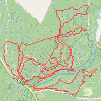
Pines MTB Trails
- Distance: 12.1 mi
- Elevation gain: 1,119 ft
- Maximum elevation: 387 ft
- Elevation loss: 1,115 ft
- Minimum elevation: 233 ft
- Moving time: 1 h 36 m
- Moving speed: 7.5 mph
- Maximum speed: 19.4 mph
- Total time: 1 h 58 m
- Global speed: 6.1 mph
Interactive trail map
Trail profile
- Distance: 12.1 mi
- Elevation gain: 1,119 ft
- Maximum elevation: 387 ft
- Elevation loss: 1,115 ft
- Minimum elevation: 233 ft
- Moving time: 1 h 36 m
- Moving speed: 7.5 mph
- Maximum speed: 19.4 mph
- Total time: 1 h 58 m
- Global speed: 6.1 mph
About this trail
Name: Pines MTB Trails trail, distance, elevation, map, profile, GPS track
Coordinates: -33.93495 115.06353 -33.92210 115.07939
Other hiking, mountain biking, running and outdoor activity trails
Click on a trail to view its statistics, map and profile.
Pines trails at Carter road MTB trails Margaret River
Bramley Mountain Biking
Distance: 9.8 mi • Elevation gain: 919 ft • Maximum elevation: 387 ft
Wooditijup National Park - Bramley Mountain Biking
Australia > Western Australia > Margaret River
Distance: 21.9 mi • Elevation gain: 1,693 ft • Maximum elevation: 400 ft