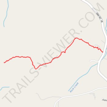
Bob Benner Memorial Trail
- Distance: 1.2 mi
- Elevation gain: 495 ft
- Maximum elevation: 1,870 ft
- Elevation loss: 66 ft
- Minimum elevation: 1,371 ft
Interactive trail map
Trail profile
- Distance: 1.2 mi
- Elevation gain: 495 ft
- Maximum elevation: 1,870 ft
- Elevation loss: 66 ft
- Minimum elevation: 1,371 ft
About this trail
Name: Bob Benner Memorial Trail trail, distance, elevation, map, profile, GPS track
End: Pleasant Grove, Burke County, North Carolina, United States (35.62469 -81.59597)
Coordinates: 35.62383 -81.59597 35.62801 -81.57957
Topography: Burke County topographic map, elevation, terrain