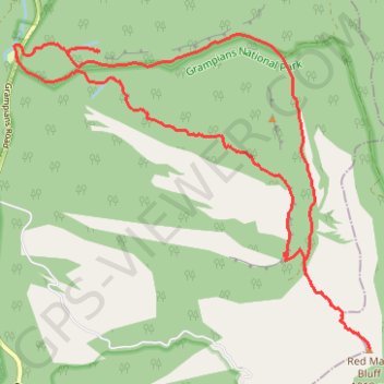
Redman Bluff Loop from Borough Huts Campground via Bari Yalug Campground, Grampians Peaks Trail, Redman Road and Seven Dials Trail
- Distance: 12.5 mi
- Elevation gain: 2,999 ft
- Maximum elevation: 3,235 ft
- Elevation loss: 3,005 ft
- Minimum elevation: 978 ft
Interactive trail map
Trail profile
- Distance: 12.5 mi
- Elevation gain: 2,999 ft
- Maximum elevation: 3,235 ft
- Elevation loss: 3,005 ft
- Minimum elevation: 978 ft
About this trail
Name: Redman Bluff Loop from Borough Huts Campground via Bari Yalug Campground, Grampians Peaks Trail, Redman Road and Seven Dials Trail trail, distance, elevation, map, profile, GPS track
Coordinates: -37.26209 142.53981 -37.22135 142.59763