Make a donation
Gear up for your next adventure:
As an Amazon Associate, this site earns from qualifying purchases at no extra cost to you.
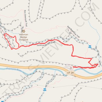
Hickman Bridge Trail in Capitol Reef National Park
The Hickman Bridge Trail in Capitol Reef National Park offers hikers a journey through diverse desert landscapes, leading to the impressive natural sandstone arch known as Hickman Bridge. Along the path, visitors can observe remnants of ancient Fremont culture, including a pit house foundation and a granary nestled within a high alcove. The trail also provides vistas of notable rock formations such as Navajo Dome and Pectols Pyramid, enhancing the scenic experience. #Hiking #Loop #Rock #Desert #Nature
- Distance: 1.7 mi
- Elevation gain: 440 ft
- Maximum elevation: 5,719 ft
- Elevation loss: 453 ft
- Minimum elevation: 5,341 ft
- Moving time: 1 h 3 m
- Moving speed: 1.6 mph
- Maximum speed: 3.6 mph
- Total time: 1 h 12 m
- Global speed: 1.4 mph
Interactive trail map
Make a donation
Gear up for your next adventure:
As an Amazon Associate, this site earns from qualifying purchases at no extra cost to you.
Trail profile
- Distance: 1.7 mi
- Elevation gain: 440 ft
- Maximum elevation: 5,719 ft
- Elevation loss: 453 ft
- Minimum elevation: 5,341 ft
- Moving time: 1 h 3 m
- Moving speed: 1.6 mph
- Maximum speed: 3.6 mph
- Total time: 1 h 12 m
- Global speed: 1.4 mph
Make a donation
Gear up for your next adventure:
As an Amazon Associate, this site earns from qualifying purchases at no extra cost to you.
About this trail
Name: Hickman Bridge Trail in Capitol Reef National Park trail, distance, elevation, map, profile, GPS track
Start: Hickman Bridge Trailhead, UT 24, Fruita, Wayne County, Utah, United States (38.28880 -111.22760)
End: Hickman Bridge Trail, Wayne County, Utah, United States (38.28875 -111.22758)
Coordinates: 38.28866 -111.23444 38.29134 -111.22511
Topography: Wayne County topographic map, elevation, terrain
Make a donation
Gear up for your next adventure:
As an Amazon Associate, this site earns from qualifying purchases at no extra cost to you.
Other hiking, mountain biking, running and outdoor activity trails
Click on a trail to view its statistics, map and profile.
Navajo Knobs
United States > Utah > Wayne County
Hike from Hickman Bridge Trailhead to Navajo Knobs via Hickman Bridge Trail, Nels Johnson Natural Bridge, Hickman Bridge, Rim Overlook Trail, Hickman Bridge Overlook, Rim Overlook and Navajo Knobs Trail in the Capitol Reef National Park. #Hiking #Nature #Rock #Canyon #Park #Rim #Overlook
Distance: 5.2 mi • Elevation gain: 2,172 ft • Maximum elevation: 6,916 ft