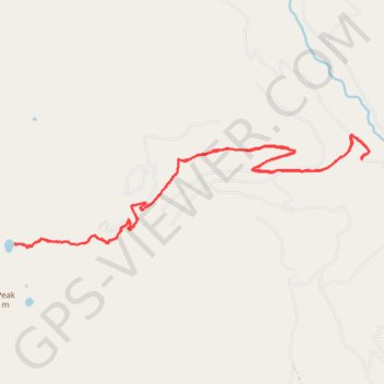
Afternoon hike at Fault Lake
- Distance: 12.0 mi
- Elevation gain: 2,900 ft
- Maximum elevation: 5,997 ft
- Elevation loss: 2,897 ft
- Minimum elevation: 3,199 ft
- Moving time: 4 h 9 m
- Moving speed: 2.9 mph
- Maximum speed: 5.4 mph
- Total time: 5 h 52 m
- Global speed: 2.0 mph
Interactive trail map
Trail profile
- Distance: 12.0 mi
- Elevation gain: 2,900 ft
- Maximum elevation: 5,997 ft
- Elevation loss: 2,897 ft
- Minimum elevation: 3,199 ft
- Moving time: 4 h 9 m
- Moving speed: 2.9 mph
- Maximum speed: 5.4 mph
- Total time: 5 h 52 m
- Global speed: 2.0 mph
About this trail
Name: Afternoon hike at Fault Lake trail, distance, elevation, map, profile, GPS track
Start: Boundary County, Idaho, United States (48.57655 -116.62181)
End: Boundary County, Idaho, United States (48.57657 -116.62188)
Coordinates: 48.56412 -116.69530 48.57998 -116.62026
Topography: Boundary County topographic map, elevation, terrain