Loop walk in Main Range National Park
Goomburra Walking
- Distance: 5.2 mi
- Elevation gain: 1,076 ft
- Maximum elevation: 3,307 ft
- Elevation loss: 1,076 ft
- Minimum elevation: 2,310 ft
- Moving time: 3 h 16 m
- Moving speed: 1.6 mph
- Maximum speed: 6.3 mph
- Total time: 4 h 31 m
- Global speed: 1.1 mph
Interactive trail map
Trail profile
- Distance: 5.2 mi
- Elevation gain: 1,076 ft
- Maximum elevation: 3,307 ft
- Elevation loss: 1,076 ft
- Minimum elevation: 2,310 ft
- Moving time: 3 h 16 m
- Moving speed: 1.6 mph
- Maximum speed: 6.3 mph
- Total time: 4 h 31 m
- Global speed: 1.1 mph
About this trail
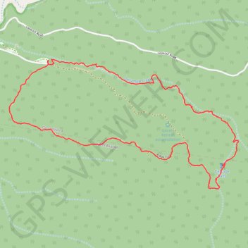
Name: Loop walk in Main Range National Park trail, distance, elevation, map, profile, GPS track
Coordinates: -27.99352 152.34321 -27.98056 152.36915