Apostle Islands Sea Caves from Meyers Beach via Lakeshore Trail in Apostle Islands National Lakeshore
The Lakeshore Trail offers a scenic hike through lush northern forests that open onto dramatic sandstone cliffs along Lake Superior. Hikers will encounter iconic views of sea caves—natural formations created by centuries of wave action—that include arches and cliffside openings where waves echo through the caves. This moderately challenging trail leads through tranquil forests of pine and birch and offers periodic lookouts over rugged shoreline cliffs, making it a memorable experience for nature enthusiasts. #Hiking #Caves #Lake #Cliff #Forest #Nature
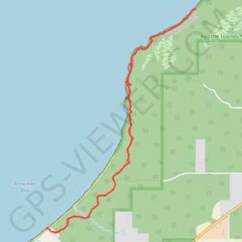
- Distance: 5.3 mi
- Elevation gain: 623 ft
- Maximum elevation: 692 ft
- Elevation loss: 656 ft
- Minimum elevation: 587 ft
- Moving time: 2 h 18 m
- Moving speed: 2.3 mph
- Maximum speed: 5.1 mph
- Total time: 2 h 41 m
- Global speed: 2.0 mph
Interactive trail map
Trail profile
- Distance: 5.3 mi
- Elevation gain: 623 ft
- Maximum elevation: 692 ft
- Elevation loss: 656 ft
- Minimum elevation: 587 ft
- Moving time: 2 h 18 m
- Moving speed: 2.3 mph
- Maximum speed: 5.1 mph
- Total time: 2 h 41 m
- Global speed: 2.0 mph
About this trail
Name: Apostle Islands Sea Caves from Meyers Beach via Lakeshore Trail in Apostle Islands National Lakeshore trail, distance, elevation, map, profile, GPS track
Coordinates: 46.88319 -91.04897 46.90778 -91.02488
Topography: Bayfield County topographic map, elevation, terrain