PCT A from Burnt Rancharia to Cibbets Flats Campground
- Distance: 10.0 mi
- Elevation gain: 604 ft
- Maximum elevation: 6,037 ft
- Elevation loss: 2,349 ft
- Minimum elevation: 4,167 ft
- Moving time: 3 h 54 m
- Moving speed: 2.6 mph
- Maximum speed: 3.8 mph
- Total time: 4 h 57 m
- Global speed: 2.0 mph
Interactive trail map
Trail profile
- Distance: 10.0 mi
- Elevation gain: 604 ft
- Maximum elevation: 6,037 ft
- Elevation loss: 2,349 ft
- Minimum elevation: 4,167 ft
- Moving time: 3 h 54 m
- Moving speed: 2.6 mph
- Maximum speed: 3.8 mph
- Total time: 4 h 57 m
- Global speed: 2.0 mph
About this trail
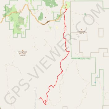
Name: PCT A from Burnt Rancharia to Cibbets Flats Campground trail, distance, elevation, map, profile, GPS track
End: Cibbets Flat Campground, San Diego County, California, United States (32.77767 -116.44575)
Coordinates: 32.77169 -116.44575 32.86268 -116.41350
Topography: San Diego County topographic map, elevation, terrain