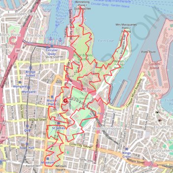
Royal Botanic Park - Sydney
Interactive trail map
Trail profile
- Distance: 8.8 mi
- Elevation gain: 1,309 ft
- Maximum elevation: 223 ft
- Elevation loss: 1,316 ft
- Minimum elevation: -10 ft
About this trail
Name: Royal Botanic Park - Sydney trail, distance, elevation, map, profile, GPS track
Coordinates: -33.87674 151.20965 -33.85631 151.22254
Other hiking, mountain biking, running and outdoor activity trails
Click on a trail to view its statistics, map and profile.
Centennial Park - Sydney
Australia > New South Wales > Sydney
#Bike #Centennial #Sydney
Distance: 18.3 mi • Elevation gain: 892 ft • Maximum elevation: 243 ft
Sydney to Oran Park NSW
Australia > New South Wales > Sydney
Distance: 37.5 mi • Elevation gain: 1,893 ft • Maximum elevation: 413 ft