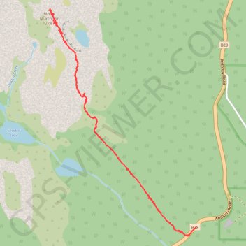
Mount Murchison Track
Interactive trail map
Trail profile
- Distance: 4.2 mi
- Elevation gain: 2,405 ft
- Maximum elevation: 4,078 ft
- Elevation loss: 2,402 ft
- Minimum elevation: 1,831 ft
- Moving time: 2 h 42 m
- Moving speed: 1.6 mph
- Maximum speed: 4.5 mph
- Total time: 4 h 54 m
- Global speed: 0.9 mph
About this trail
Name: Mount Murchison Track trail, distance, elevation, map, profile, GPS track
Start: Anthony Road, Tullah, West Coast, Tasmania, 7321, Australia (-41.82650 145.63382)
End: Anthony Road, Tullah, West Coast, Tasmania, 7321, Australia (-41.82657 145.63372)
Coordinates: -41.82730 145.61797 -41.80893 145.63382