Pigeon House Mountain
Morton National Park. #Hiking #PigeonHouse #Morton
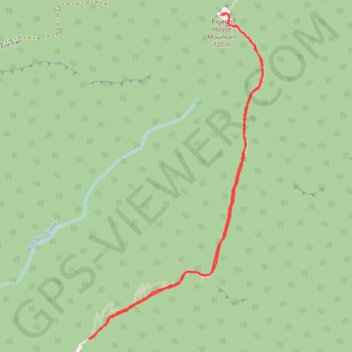
- Distance: 3.4 mi
- Elevation gain: 1,398 ft
- Maximum elevation: 2,119 ft
- Elevation loss: 1,398 ft
- Minimum elevation: 741 ft
Interactive trail map
Trail profile
- Distance: 3.4 mi
- Elevation gain: 1,398 ft
- Maximum elevation: 2,119 ft
- Elevation loss: 1,398 ft
- Minimum elevation: 741 ft
About this trail
Name: Pigeon House Mountain trail, distance, elevation, map, profile, GPS track
Coordinates: -35.36690 150.25616 -35.34926 150.26771
Other hiking, mountain biking, running and outdoor activity trails
Click on a trail to view its statistics, map and profile.
Pigeon House Mountain Didthul
Distance: 3.6 mi • Elevation gain: 1,388 ft • Maximum elevation: 2,116 ft