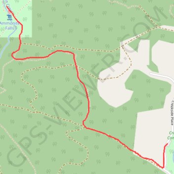
Ammonite Falls
Interactive trail map
Trail profile
- Distance: 3.0 mi
- Elevation gain: 512 ft
- Maximum elevation: 883 ft
- Elevation loss: 512 ft
- Minimum elevation: 682 ft
About this trail
Name: Ammonite Falls trail, distance, elevation, map, profile, GPS track
Coordinates: 49.17988 -124.07942 49.19060 -124.06305
Other hiking, mountain biking, running and outdoor activity trails
Click on a trail to view its statistics, map and profile.
Witchcraft Lake - Benson Creek - Mount Benson
Canada > British Columbia > Regional District of Nanaimo > Area C (Arrowsmith-Benson)
Mount Benson Regional Park. #Hiking #Loop #MountBenson
Distance: 9.2 mi • Elevation gain: 2,792 ft • Maximum elevation: 3,301 ft