Lake Clementine via Clementine Trail in Auburn State Recreation Area
The Clementine Trail, winding through the Auburn State Recreation Area, offers an enjoyable journey with picturesque views of both the American River and the surrounding terrain. Hikers will pass beneath the towering Foresthill Bridge, the tallest bridge in California, and be treated to dramatic vistas of the water below and the nearby North Fork Dam, with opportunities for photos, especially as the dam cascades into a pool below. The shaded trail, flanked by oak and conifer trees, provides ample breaks from the sun, though some rocky sections require sturdy footwear. #Hiking #Lake #Forest #Nature #River #Dam
- Distance: 4.5 mi
- Elevation gain: 1,043 ft
- Maximum elevation: 991 ft
- Elevation loss: 1,030 ft
- Minimum elevation: 594 ft
- Moving time: 1 h 39 m
- Moving speed: 2.7 mph
- Maximum speed: 4.1 mph
- Total time: 2 h 7 m
- Global speed: 2.1 mph
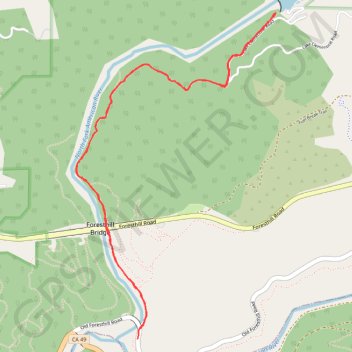
Interactive trail map
Trail profile
- Distance: 4.5 mi
- Elevation gain: 1,043 ft
- Maximum elevation: 991 ft
- Elevation loss: 1,030 ft
- Minimum elevation: 594 ft
- Moving time: 1 h 39 m
- Moving speed: 2.7 mph
- Maximum speed: 4.1 mph
- Total time: 2 h 7 m
- Global speed: 2.1 mph
About this trail
Name: Lake Clementine via Clementine Trail in Auburn State Recreation Area trail, distance, elevation, map, profile, GPS track
Start: Old Foresthill Road, Placer County, California, 95604, United States (38.91606 -121.03572)
End: Old Foresthill Road, Placer County, California, 95614, United States (38.91549 -121.03582)
Coordinates: 38.91549 -121.04071 38.93572 -121.02474
Topography: Placer County topographic map, elevation, terrain