Make a donation
Gear up for your next adventure:
As an Amazon Associate, this site earns from qualifying purchases at no extra cost to you.
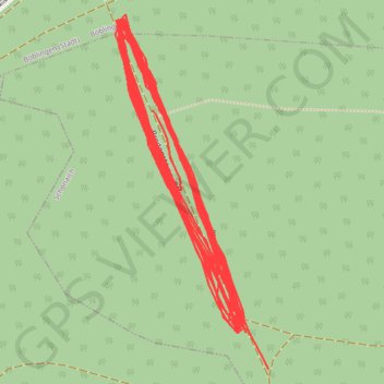
Vertical Competition
- Distance: 5.8 mi
- Elevation gain: 1,949 ft
- Maximum elevation: 1,667 ft
- Elevation loss: 1,831 ft
- Minimum elevation: 1,493 ft
- Moving time: 59 m 58 s
- Moving speed: 5.8 mph
- Maximum speed: 13.9 mph
- Total time: 59 m 58 s
- Global speed: 5.8 mph
Interactive trail map
Make a donation
Gear up for your next adventure:
As an Amazon Associate, this site earns from qualifying purchases at no extra cost to you.
Trail profile
- Distance: 5.8 mi
- Elevation gain: 1,949 ft
- Maximum elevation: 1,667 ft
- Elevation loss: 1,831 ft
- Minimum elevation: 1,493 ft
- Moving time: 59 m 58 s
- Moving speed: 5.8 mph
- Maximum speed: 13.9 mph
- Total time: 59 m 58 s
- Global speed: 5.8 mph
Make a donation
Gear up for your next adventure:
As an Amazon Associate, this site earns from qualifying purchases at no extra cost to you.
About this trail
Name: Vertical Competition trail, distance, elevation, map, profile, GPS track
Coordinates: 48.66135 9.02313 48.66479 9.02538
Make a donation
Gear up for your next adventure:
As an Amazon Associate, this site earns from qualifying purchases at no extra cost to you.
Other hiking, mountain biking, running and outdoor activity trails
Click on a trail to view its statistics, map and profile.
Track vom: 2020-06-13 07:00
Germany > North Rhine-Westphalia > Kreis Wesel > Schermbeck
Distance: 422.5 mi • Elevation gain: 17,392 ft • Maximum elevation: 3,022 ft
Track vom: 2020-06-27 07:26
Germany > Bavaria > Landkreis Ostallgäu > Halblech
Distance: 427.6 mi • Elevation gain: 14,131 ft • Maximum elevation: 2,989 ft
Riethoven naar Oostenrijk
Netherlands > North Brabant > Riethoven > Eind
Distance: 573.0 mi • Elevation gain: 44,715 ft • Maximum elevation: 6,224 ft
PT23BS1 Kiel → Lörrach
Germany > Schleswig-Holstein > Kiel
Distance: 650.4 mi • Elevation gain: 30,397 ft • Maximum elevation: 2,484 ft
Make a donation
Gear up for your next adventure:
As an Amazon Associate, this site earns from qualifying purchases at no extra cost to you.