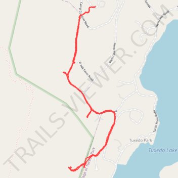
Tuxedo Park bridle paths
- Distance: 3.3 mi
- Elevation gain: 479 ft
- Maximum elevation: 892 ft
- Elevation loss: 479 ft
- Minimum elevation: 627 ft
- Moving time: 1 h 27 m
- Moving speed: 2.2 mph
- Maximum speed: 4.3 mph
- Total time: 2 h 18 m
- Global speed: 1.4 mph
Interactive trail map
Trail profile
- Distance: 3.3 mi
- Elevation gain: 479 ft
- Maximum elevation: 892 ft
- Elevation loss: 479 ft
- Minimum elevation: 627 ft
- Moving time: 1 h 27 m
- Moving speed: 2.2 mph
- Maximum speed: 4.3 mph
- Total time: 2 h 18 m
- Global speed: 1.4 mph
About this trail
Name: Tuxedo Park bridle paths trail, distance, elevation, map, profile, GPS track
Coordinates: 41.19422 -74.21971 41.20905 -74.21342
Topography: Orange County topographic map, elevation, terrain