
2025-05-04_16-55_Sun-PCMIDDLE
- Distance: 2.0 mi
- Elevation gain: 46 ft
- Maximum elevation: 62 ft
- Elevation loss: 46 ft
- Minimum elevation: 33 ft
- Moving time: 8 m 28 s
- Moving speed: 14.5 mph
- Maximum speed: 26.4 mph
- Total time: 8 m 28 s
- Global speed: 14.5 mph
Interactive trail map
Trail profile
- Distance: 2.0 mi
- Elevation gain: 46 ft
- Maximum elevation: 62 ft
- Elevation loss: 46 ft
- Minimum elevation: 33 ft
- Moving time: 8 m 28 s
- Moving speed: 14.5 mph
- Maximum speed: 26.4 mph
- Total time: 8 m 28 s
- Global speed: 14.5 mph
About this trail
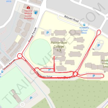
Name: 2025-05-04_16-55_Sun-PCMIDDLE trail, distance, elevation, map, profile, GPS track
Coordinates: -12.51201 130.98872 -12.50963 130.99376