
Tutshi Peak Loop
- Distance: 9.2 mi
- Elevation gain: 4,386 ft
- Maximum elevation: 6,660 ft
- Elevation loss: 4,511 ft
- Minimum elevation: 2,405 ft
- Moving time: 5 h 44 m
- Moving speed: 1.6 mph
- Maximum speed: 5.2 mph
- Total time: 8 h 28 m
- Global speed: 1.1 mph
Interactive trail map
Trail profile
- Distance: 9.2 mi
- Elevation gain: 4,386 ft
- Maximum elevation: 6,660 ft
- Elevation loss: 4,511 ft
- Minimum elevation: 2,405 ft
- Moving time: 5 h 44 m
- Moving speed: 1.6 mph
- Maximum speed: 5.2 mph
- Total time: 8 h 28 m
- Global speed: 1.1 mph
About this trail
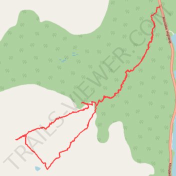
Name: Tutshi Peak Loop trail, distance, elevation, map, profile, GPS track
Start: Klondike Highway, Stikine Region, British Columbia, Canada (59.88794 -134.79927)
End: Klondike Highway, Stikine Region, British Columbia, Canada (59.89076 -134.79586)
Coordinates: 59.85591 -134.85727 59.89076 -134.79586