Acadia - Cadillac South Trail and Triad Trail
- Distance: 4.3 mi
- Elevation gain: 1,332 ft
- Maximum elevation: 1,368 ft
- Elevation loss: 1,470 ft
- Minimum elevation: 207 ft
- Moving time: 2 h 17 m
- Moving speed: 1.9 mph
- Maximum speed: 4.5 mph
- Total time: 3 h 15 m
- Global speed: 1.3 mph
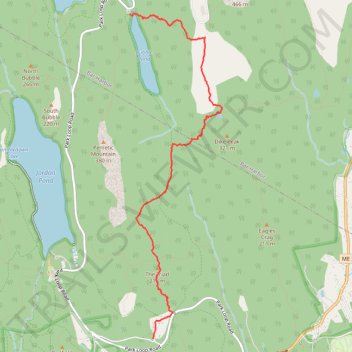
Interactive trail map
Trail profile
- Distance: 4.3 mi
- Elevation gain: 1,332 ft
- Maximum elevation: 1,368 ft
- Elevation loss: 1,470 ft
- Minimum elevation: 207 ft
- Moving time: 2 h 17 m
- Moving speed: 1.9 mph
- Maximum speed: 4.5 mph
- Total time: 3 h 15 m
- Global speed: 1.3 mph
About this trail
Name: Acadia - Cadillac South Trail and Triad Trail trail, distance, elevation, map, profile, GPS track
End: Dane Farm Road, Mount Desert, Hancock County, Maine, 04675, United States (44.31297 -68.23755)
Coordinates: 44.31292 -68.24118 44.34969 -68.22668
Topography: Hancock County topographic map, elevation, terrain
Other hiking, mountain biking, running and outdoor activity trails
Click on a trail to view its statistics, map and profile.
Cadillac Mountain Summit via Cadillac South Ridge Trail in Acadia National Park
United States > Maine > Hancock County > Mount Desert
The Cadillac Mountain South Ridge Trail in Acadia National Park offers hikers a rewarding journey through diverse landscapes, including white pine and spruce forests, the Featherbed pond, open granite ridges, and culminating in panoramic vistas from the summit. The trail begins with a gentle ascent through…
Distance: 7.0 mi • Elevation gain: 1,457 ft • Maximum elevation: 1,509 ft
Cadillac Mountain via Cadillac South Ridge Trail in Acadia National Park
United States > Maine > Hancock County > Mount Desert
The Cadillac South Ridge Trail offers a captivating journey to the summit of Cadillac Mountain in Acadia National Park, with a diverse landscape that transitions from lush forests to exposed granite ridges. Hikers can enjoy spectacular views of the Gulf of Maine and nearby islands, especially as they ascend…
Distance: 7.1 mi • Elevation gain: 1,457 ft • Maximum elevation: 1,506 ft
Cadillac Mountain Loop via A Murray Young Path, Canon Brook Trail and Cadillac South Ridge Trail
United States > Maine > Hancock County > Bar Harbor
Distance: 3.9 mi • Elevation gain: 1,325 ft • Maximum elevation: 1,506 ft
Acadia loop hike via Pemetic Mountain, Bubble Pond, Eagle Lake, Conners Nubble and North Bubble
United States > Maine > Hancock County > Mount Desert
Distance: 5.8 mi • Elevation gain: 1,463 ft • Maximum elevation: 1,217 ft
Cadillac Mountain Loop Trail
United States > Maine > Hancock County > Bar Harbor
Distance: 7.5 mi • Elevation gain: 1,850 ft • Maximum elevation: 1,506 ft