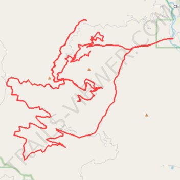
Swartz Creek loop
- Distance: 50.7 mi
- Elevation gain: 8,816 ft
- Maximum elevation: 5,843 ft
- Elevation loss: 8,816 ft
- Minimum elevation: 3,478 ft
- Moving time: 6 h 23 m
- Moving speed: 7.9 mph
- Maximum speed: 29.4 mph
- Total time: 7 h 4 m
- Global speed: 7.2 mph
Interactive trail map
Trail profile
- Distance: 50.7 mi
- Elevation gain: 8,816 ft
- Maximum elevation: 5,843 ft
- Elevation loss: 8,816 ft
- Minimum elevation: 3,478 ft
- Moving time: 6 h 23 m
- Moving speed: 7.9 mph
- Maximum speed: 29.4 mph
- Total time: 7 h 4 m
- Global speed: 7.2 mph
About this trail
Name: Swartz Creek loop trail, distance, elevation, map, profile, GPS track
Coordinates: 46.68638 -113.84876 46.76177 -113.71870
Topography: Missoula County topographic map, elevation, terrain