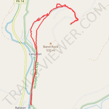
McIntyre Wild Area - Dutchmans Run Falls and McIntyre Cemetery
- Distance: 5.3 mi
- Elevation gain: 1,115 ft
- Maximum elevation: 1,801 ft
- Elevation loss: 1,119 ft
- Minimum elevation: 856 ft
Interactive trail map
Trail profile
- Distance: 5.3 mi
- Elevation gain: 1,115 ft
- Maximum elevation: 1,801 ft
- Elevation loss: 1,119 ft
- Minimum elevation: 856 ft
About this trail
Name: McIntyre Wild Area - Dutchmans Run Falls and McIntyre Cemetery trail, distance, elevation, map, profile, GPS track
Coordinates: 41.50705 -76.95125 41.52836 -76.93780
Topography: McIntyre Township topographic map, elevation, terrain