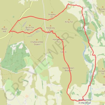
Widecombe in the Moor - Dartmoor National Park
Interactive trail map
Trail profile
- Distance: 12.3 mi
- Elevation gain: 2,054 ft
- Maximum elevation: 1,739 ft
- Elevation loss: 2,054 ft
- Minimum elevation: 817 ft
About this trail
Name: Widecombe in the Moor - Dartmoor National Park trail, distance, elevation, map, profile, GPS track
Coordinates: 50.57693 -3.87519 50.62803 -3.80331