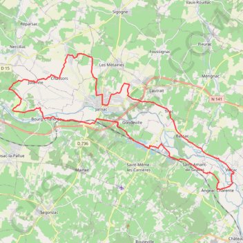
Boucle à Jarnac
- Distance: 28.8 mi
- Elevation gain: 758 ft
- Maximum elevation: 171 ft
- Elevation loss: 758 ft
- Minimum elevation: 30 ft
Interactive trail map
Trail profile
- Distance: 28.8 mi
- Elevation gain: 758 ft
- Maximum elevation: 171 ft
- Elevation loss: 758 ft
- Minimum elevation: 30 ft
About this trail
Name: Boucle à Jarnac trail, distance, elevation, map, profile, GPS track
Coordinates: 45.63078 -0.25288 45.71200 -0.06067
Other hiking, mountain biking, running and outdoor activity trails
Click on a trail to view its statistics, map and profile.
Chemin de Saint-Jacques-de-Compostelle
Switzerland > Geneva > Geneva
Distance: 694.6 mi • Elevation gain: 82,881 ft • Maximum elevation: 4,692 ft