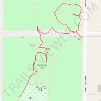
Dignowity Park and Lockwood Park
- Distance: 0.3 mi
- Elevation gain: 7 ft
- Maximum elevation: 748 ft
- Elevation loss: 20 ft
- Minimum elevation: 735 ft
- Moving time: 7 m 17 s
- Moving speed: 2.5 mph
- Maximum speed: 9.2 mph
- Total time: 8 m 23 s
- Global speed: 2.2 mph
Interactive trail map
Trail profile
- Distance: 0.3 mi
- Elevation gain: 7 ft
- Maximum elevation: 748 ft
- Elevation loss: 20 ft
- Minimum elevation: 735 ft
- Moving time: 7 m 17 s
- Moving speed: 2.5 mph
- Maximum speed: 9.2 mph
- Total time: 8 m 23 s
- Global speed: 2.2 mph
About this trail
Name: Dignowity Park and Lockwood Park trail, distance, elevation, map, profile, GPS track
Coordinates: 29.42800 -98.47290 29.42938 -98.47183
Topography: San Antonio topographic map, elevation, terrain