
Rhett's Run MTB Trail in Cosmo Park
- Distance: 5.2 mi
- Elevation gain: 466 ft
- Maximum elevation: 745 ft
- Elevation loss: 466 ft
- Minimum elevation: 623 ft
Interactive trail map
Trail profile
- Distance: 5.2 mi
- Elevation gain: 466 ft
- Maximum elevation: 745 ft
- Elevation loss: 466 ft
- Minimum elevation: 623 ft
About this trail
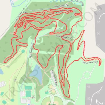
Name: Rhett's Run MTB Trail in Cosmo Park trail, distance, elevation, map, profile, GPS track
Start: Cosmo Park Trail, Columbia, Boone County, Missouri, 65216, United States (38.97843 -92.35983)
End: Cosmo Park Trail, Columbia, Boone County, Missouri, 65216, United States (38.97841 -92.35983)
Coordinates: 38.97806 -92.36584 38.98458 -92.35679
Topography: Columbia topographic map, elevation, terrain