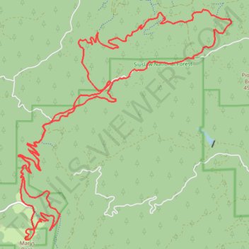
Tum Tum and Marys Peak
- Distance: 22.5 mi
- Elevation gain: 5,413 ft
- Maximum elevation: 4,072 ft
- Elevation loss: 5,417 ft
- Minimum elevation: 892 ft
- Moving time: 4 h 38 m
- Moving speed: 4.8 mph
- Maximum speed: 9.8 mph
- Total time: 4 h 52 m
- Global speed: 4.6 mph
Interactive trail map
Trail profile
- Distance: 22.5 mi
- Elevation gain: 5,413 ft
- Maximum elevation: 4,072 ft
- Elevation loss: 5,417 ft
- Minimum elevation: 892 ft
- Moving time: 4 h 38 m
- Moving speed: 4.8 mph
- Maximum speed: 9.8 mph
- Total time: 4 h 52 m
- Global speed: 4.6 mph
About this trail
Name: Tum Tum and Marys Peak trail, distance, elevation, map, profile, GPS track
Start: Woods Creek Road, Benton County, Oregon, United States (44.54498 -123.49927)
End: Woods Creek Road, Benton County, Oregon, United States (44.54507 -123.49907)
Coordinates: 44.50372 -123.55578 44.55629 -123.48697
Topography: Benton County topographic map, elevation, terrain