Make a donation
Gear up for your next adventure:
As an Amazon Associate, this site earns from qualifying purchases at no extra cost to you.
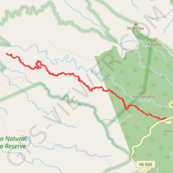
Awa'awapuhi Trail (Kauai Island)
Hike on Awa'awapuhi Trail in the Na Pali-Kona Forest Reserve. #Hiking #Mountain #Volcano #Forest #Nature #Sea #Pacific #Ocean #Hawaii #Island
- Distance: 6.3 mi
- Elevation gain: 1,939 ft
- Maximum elevation: 4,094 ft
- Elevation loss: 1,936 ft
- Minimum elevation: 2,303 ft
- Moving time: 3 h 9 m
- Moving speed: 2.0 mph
- Maximum speed: 23.0 mph
- Total time: 3 h 41 m
- Global speed: 1.7 mph
Interactive trail map
Make a donation
Gear up for your next adventure:
As an Amazon Associate, this site earns from qualifying purchases at no extra cost to you.
Trail profile
- Distance: 6.3 mi
- Elevation gain: 1,939 ft
- Maximum elevation: 4,094 ft
- Elevation loss: 1,936 ft
- Minimum elevation: 2,303 ft
- Moving time: 3 h 9 m
- Moving speed: 2.0 mph
- Maximum speed: 23.0 mph
- Total time: 3 h 41 m
- Global speed: 1.7 mph
Make a donation
Gear up for your next adventure:
As an Amazon Associate, this site earns from qualifying purchases at no extra cost to you.
About this trail
Name: Awa'awapuhi Trail (Kauai Island) trail, distance, elevation, map, profile, GPS track
Start: Awa'awapuhi Trailhead, Awa'awapuhi Trail, Kauaʻi County, Hawaii, United States (22.14152 -159.64866)
End: Awa'awapuhi Trail, Kauaʻi County, Hawaii, United States (22.14136 -159.64886)
Coordinates: 22.14113 -159.68143 22.15367 -159.64866
Topography: Kauaʻi County topographic map, elevation, terrain
Make a donation
Gear up for your next adventure:
As an Amazon Associate, this site earns from qualifying purchases at no extra cost to you.
Other hiking, mountain biking, running and outdoor activity trails
Click on a trail to view its statistics, map and profile.
Pu'u O Kila Lookout to Koke'e Campground (Kauai Island)
United States > Hawaii > Kauaʻi County
Hike from Pu'u O Kila Lookout to Koke'e Campground via Pihea Trail, Kawaikoi, camp 10 Road, Alaka'i Picnic Area, Mohihi Road, Pu'u Ka'ohelo-Berry Flat Trail, Water Tank Trail and Pau Kaohela in the Koke'e State Park. #Hiking #Mountain #Volcano #Nature #Forest #Park #Hawaii
Distance: 8.9 mi • Elevation gain: 1,388 ft • Maximum elevation: 4,140 ft
Lolo Vista and Nu'alolo Cliffs Loop (Kaua'i Island)
United States > Hawaii > Kauaʻi County
Loop hike to Lolo Vista and Nu'alolo Cliffs via Nu'alolo Trail, Nu'alolo Cliffs Trail, Awa'awapuhi Trail and Koke'e Road in the Koke'e State Park, Ku'ia Natural Area Reserve and Na Pali-Kona Forest Reserve. #Hiking #Loop #Mountain #Volcano #Nature #Forest #Cliffs #Ocean #Sea #Pacific #Island #Hawaii #Island
Distance: 11.7 mi • Elevation gain: 3,166 ft • Maximum elevation: 4,098 ft