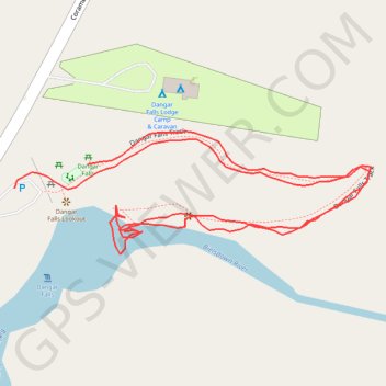
Dangar Falls - Bielsdown River
- Distance: 0.8 mi
- Elevation gain: 66 ft
- Maximum elevation: 2,293 ft
- Elevation loss: 56 ft
- Minimum elevation: 2,234 ft
- Moving time: 18 m
- Moving speed: 2.6 mph
- Maximum speed: 4.0 mph
- Total time: 23 m 4 s
- Global speed: 2.0 mph
Interactive trail map
Trail profile
- Distance: 0.8 mi
- Elevation gain: 66 ft
- Maximum elevation: 2,293 ft
- Elevation loss: 56 ft
- Minimum elevation: 2,234 ft
- Moving time: 18 m
- Moving speed: 2.6 mph
- Maximum speed: 4.0 mph
- Total time: 23 m 4 s
- Global speed: 2.0 mph
About this trail
Name: Dangar Falls - Bielsdown River trail, distance, elevation, map, profile, GPS track
Coordinates: -30.32308 152.71398 -30.32215 152.71711