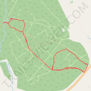
Wandering through the woods - Kinnaird Forest
- Distance: 2.9 mi
- Elevation gain: 246 ft
- Maximum elevation: 1,388 ft
- Elevation loss: 315 ft
- Minimum elevation: 1,243 ft
- Moving time: 3 h 57 m
- Moving speed: 0.7 mph
- Maximum speed: 5.6 mph
- Total time: 4 h 29 m
- Global speed: 0.6 mph
Interactive trail map
Trail profile
- Distance: 2.9 mi
- Elevation gain: 246 ft
- Maximum elevation: 1,388 ft
- Elevation loss: 315 ft
- Minimum elevation: 1,243 ft
- Moving time: 3 h 57 m
- Moving speed: 0.7 mph
- Maximum speed: 5.6 mph
- Total time: 4 h 29 m
- Global speed: 0.6 mph
About this trail
Name: Wandering through the woods - Kinnaird Forest trail, distance, elevation, map, profile, GPS track
Start: Kinnaird, Perth and Kinross, Scotland, PH16 5JL, United Kingdom (56.72882 -3.68540)
End: A924, Pittarrig, Kinnaird, Perth and Kinross, Scotland, PH16 5JN, United Kingdom (56.72550 -3.67136)
Coordinates: 56.72548 -3.69220 56.73317 -3.67026