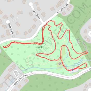
Sargeant Park
- Distance: 1.1 mi
- Elevation gain: 89 ft
- Maximum elevation: 755 ft
- Elevation loss: 102 ft
- Minimum elevation: 682 ft
- Moving time: 33 m 25 s
- Moving speed: 2.0 mph
- Maximum speed: 3.7 mph
- Total time: 48 m 10 s
- Global speed: 1.4 mph
Interactive trail map
Trail profile
- Distance: 1.1 mi
- Elevation gain: 89 ft
- Maximum elevation: 755 ft
- Elevation loss: 102 ft
- Minimum elevation: 682 ft
- Moving time: 33 m 25 s
- Moving speed: 2.0 mph
- Maximum speed: 3.7 mph
- Total time: 48 m 10 s
- Global speed: 1.4 mph
About this trail
Name: Sargeant Park trail, distance, elevation, map, profile, GPS track
Coordinates: 39.10224 -84.46450 39.10427 -84.46009
Topography: Campbell County topographic map, elevation, terrain