Make a donation
Gear up for your next adventure:
As an Amazon Associate, this site earns from qualifying purchases at no extra cost to you.
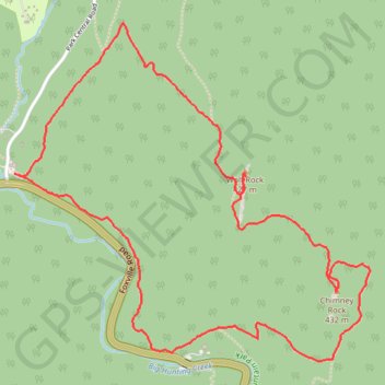
Wolf Rock and Chimney Rock Loop in Catoctin Mountain Park
The Wolf Rock and Chimney Rock Loop is a scenic, moderate hike that offers a blend of rocky terrain and breathtaking vistas. As you journey through dense hardwood forests, you'll encounter two major rock formations: Wolf Rock, a vast rocky ridge, and Chimney Rock, a prominent outcrop that provides panoramic views of the surrounding mountains and the town of Thurmont. While the initial steep climb to Wolf Rock may challenge hikers, the path flattens afterward, making for a more relaxed journey toward Chimney Rock, where the rewarding views truly shine. #Hiking #Loop #Mountain #Rock #Overlook #Forest #Nature
- Distance: 3.8 mi
- Elevation gain: 830 ft
- Maximum elevation: 1,522 ft
- Elevation loss: 823 ft
- Minimum elevation: 860 ft
- Moving time: 1 h 36 m
- Moving speed: 2.4 mph
- Maximum speed: 4.5 mph
- Total time: 1 h 59 m
- Global speed: 1.9 mph
Interactive trail map
Make a donation
Gear up for your next adventure:
As an Amazon Associate, this site earns from qualifying purchases at no extra cost to you.
Trail profile
- Distance: 3.8 mi
- Elevation gain: 830 ft
- Maximum elevation: 1,522 ft
- Elevation loss: 823 ft
- Minimum elevation: 860 ft
- Moving time: 1 h 36 m
- Moving speed: 2.4 mph
- Maximum speed: 4.5 mph
- Total time: 1 h 59 m
- Global speed: 1.9 mph
Make a donation
Gear up for your next adventure:
As an Amazon Associate, this site earns from qualifying purchases at no extra cost to you.
About this trail
Name: Wolf Rock and Chimney Rock Loop in Catoctin Mountain Park trail, distance, elevation, map, profile, GPS track
Coordinates: 39.62623 -77.44981 39.63994 -77.43105
Topography: Frederick County topographic map, elevation, terrain
Make a donation
Gear up for your next adventure:
As an Amazon Associate, this site earns from qualifying purchases at no extra cost to you.
Other hiking, mountain biking, running and outdoor activity trails
Click on a trail to view its statistics, map and profile.
Chimney Rock, Thurmont Vista, Blue Ridge Summit Vista, Hog Rock and Cunningham Falls Loop
United States > Maryland > Frederick County
This loop hike in Catoctin Mountain Park offers a dynamic journey through diverse terrain, highlighting Maryland’s scenic views and rock formations. Starting at Chimney Rock, hikers can enjoy panoramic views over the Piedmont and continue through forested trails to Wolf Rock and Thurmont Vista, where vistas…
Distance: 8.9 mi • Elevation gain: 1,614 ft • Maximum elevation: 1,660 ft