
Hinkler Reserve along the fences
- Distance: 0.9 mi
- Elevation gain: 49 ft
- Maximum elevation: 335 ft
- Elevation loss: 49 ft
- Minimum elevation: 312 ft
- Moving time: 31 m 14 s
- Moving speed: 1.7 mph
- Maximum speed: 4.1 mph
- Total time: 34 m 7 s
- Global speed: 1.5 mph
Interactive trail map
Trail profile
- Distance: 0.9 mi
- Elevation gain: 49 ft
- Maximum elevation: 335 ft
- Elevation loss: 49 ft
- Minimum elevation: 312 ft
- Moving time: 31 m 14 s
- Moving speed: 1.7 mph
- Maximum speed: 4.1 mph
- Total time: 34 m 7 s
- Global speed: 1.5 mph
About this trail
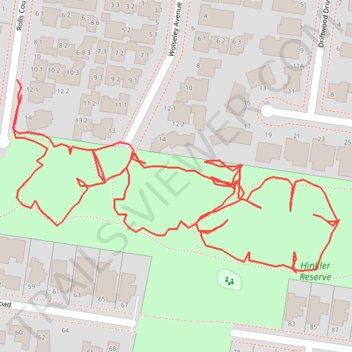
Name: Hinkler Reserve along the fences trail, distance, elevation, map, profile, GPS track
Start: 12, Rolls Court, Glen Waverley, Melbourne, Victoria, 3150, Australia (-37.87979 145.17277)
End: 12, Rolls Court, Glen Waverley, Melbourne, Victoria, 3150, Australia (-37.87969 145.17273)
Coordinates: -37.88098 145.17270 -37.87969 145.17546
Other hiking, mountain biking, running and outdoor activity trails
Click on a trail to view its statistics, map and profile.

